Master Topographic Maps: Your Essential Guide to Terrain
“`html
Understanding how to read topographic maps is an essential skill for outdoor enthusiasts, hikers, and anyone who ventures into natural landscapes. These maps provide valuable information about the terrain, elevation, and features of the land, making them indispensable for navigation and planning. This guide will explore the nuances of topographic maps, including their features, how to interpret them, and practical applications.
1. What is a Topographic Map?
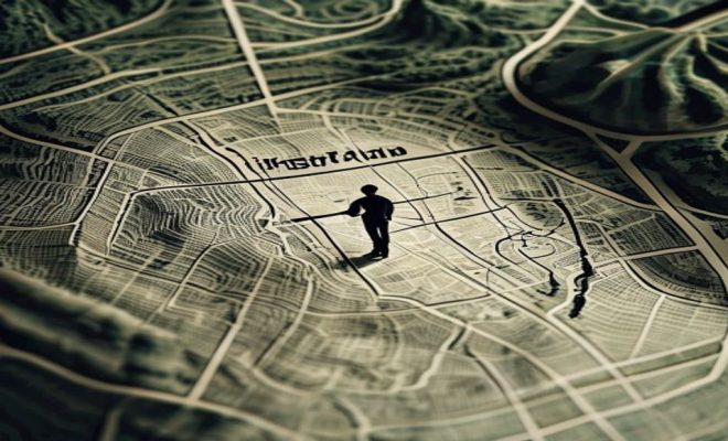
Topographic maps are detailed representations of the Earth’s surface, showcasing the three-dimensional features of the land on a two-dimensional plane. They use contour lines to illustrate elevation changes, allowing users to visualize the terrain’s shape and steepness. Unlike regular maps, which may focus on roads and urban features, topographic maps emphasize natural features like mountains, valleys, and bodies of water.
A standard topographic map includes symbols and colors to denote different types of terrain and features. For example, green often indicates forests, blue marks water bodies, and brown represents elevation lines. Understanding these elements is crucial for interpreting the map correctly.
2. Understanding Contour Lines
One of the key aspects of how to read topographic maps lies in the contour lines that cover the map. These lines connect points of equal elevation, allowing you to gauge the height of the land in relation to sea level. Contour lines that are close together indicate steep terrain, while lines spaced farther apart suggest a more gradual slope.
Each contour line is marked with its elevation, usually in feet or meters, providing a reference point for the terrain’s steepness. By analyzing the spacing and pattern of these lines, you can visualize whether you’re traversing a valley, climbing a hill, or navigating a plateau. For example, a series of concentric circles often represents a hill, with the innermost circle being the peak.
3. Interpreting Elevation and Relief
To effectively understand how to read topographic maps, it’s essential to grasp the concepts of elevation and relief. Elevation refers to the height of a point above sea level, while relief describes the variations in elevation in a given area. High relief areas are characterized by significant elevation differences, while low relief areas have minimal changes in height.
For hikers or outdoor adventurers, knowing the elevation can provide important information about the difficulty of a trail. Steeper trails with a greater change in elevation require more stamina and can present challenges like climbing. By studying the relief on a topographic map, you can anticipate these challenges and prepare accordingly.
4. Reading Map Symbols
Topographic maps are filled with various symbols that represent different features of the landscape. Understanding these symbols is crucial for effective navigation. Common symbols include lines for roads and trails, dots for buildings, and different shapes for water bodies.
Most topographic maps come with a legend, which explains the symbols used. Familiarizing yourself with these symbols can greatly enhance your ability to interpret the map. For instance, knowing that a dashed line indicates a trail can help you plan your route effectively. In addition, some maps may include shaded relief, which adds a three-dimensional effect and can help you better visualize the terrain. (See: Wikipedia on topographic maps.)
5. Identifying Land Features
Topographic maps provide a wealth of information about land features, including hills, valleys, ridges, and depressions. Learning how to read these features can aid in navigation and understanding the landscape. For example, a ridge is typically shown as a series of closely spaced contour lines that may form a ‘V’ shape pointing downhill, while a valley will appear as a ‘U’ shape.
Recognizing these patterns is vital for outdoor activities. If you’re planning a hike, knowing where ridges and valleys are located can help you choose a safer and more enjoyable route. Additionally, some features, like cliffs or steep slopes, may be indicated by contour lines that form a series of sharp turns, signaling potential hazards.
6. Using Scale for Distance Estimation
Understanding scale is another critical aspect of how to read topographic maps. The scale indicates the relationship between distances on the map and actual distances on the ground. Most topographic maps will have a graphic scale that visually represents this relationship.
To estimate distances on the map, you can measure between points using a ruler and then translate that measurement using the scale. This practice is invaluable for hikers, as it allows you to plan your hiking distances and estimated travel times accurately. For instance, if your map’s scale indicates that one inch equals one mile, you can determine how far apart two points are in reality by measuring their distance on the map and converting it accordingly.
7. Plan Your Route
Once you have a solid understanding of how to read topographic maps, the next step is planning your route. Whether you’re preparing for a day hike or a multi-day backpacking trip, a topographic map allows you to identify the best paths based on terrain. Look for trails, roads, and access points that align with your planned adventure.
Consider factors such as elevation changes, terrain difficulty, and potential water sources. This information can help you choose a route that matches your skill level and physical condition. It’s also wise to note alternative routes in case of unexpected conditions like closed trails or adverse weather. Having this foresight can make all the difference in ensuring a smooth trip.
8. Practical Applications Beyond Hiking
While topographic maps are often associated with hiking and outdoor recreation, their applications extend beyond these activities. They are widely used in fields like geology, environmental science, civil engineering, and urban planning. Professionals in these industries rely on topographic maps to assess land use, plan construction projects, and evaluate environmental impacts.
For instance, engineers might use these maps to understand the terrain before building roads or bridges, ensuring that their designs accommodate natural land features. Similarly, ecologists may analyze topographic maps to study ecosystems and habitat distribution. Understanding topographic maps can thus open doors to many career paths.
9. Current Relevance and Technology Integration
In today’s digital age, the integration of technology with topographic maps has revolutionized their use. GPS devices and smartphone apps have made it easier than ever to access topographic map data in real-time. Many outdoor enthusiasts now use apps equipped with topographic maps to navigate during their adventures.
These apps often incorporate features like tracking your location, marking waypoints, and providing elevation data on the go. However, having a physical map as a backup is still wise, as electronic devices can fail or run out of battery. Understanding how to read topographic maps remains a critical skill, regardless of technological advancements. As you venture outdoors, the ability to interpret these maps can enhance your experiences and ensure your safety.
10. Common Mistakes When Reading Topographic Maps
Even experienced users can make mistakes when interpreting topographic maps. Here are some common pitfalls to watch out for: (See: USGS on topographic maps.)
- Ignoring the Legend: Always refer to the legend to understand the symbols and colors used. Skipping this step can lead to misinterpretation.
- Misjudging Elevation Changes: Not accounting for steep elevation changes can lead to underestimating the difficulty of a hike. Always analyze the spacing of contour lines before setting out.
- Overlooking Terrain Features: Failing to recognize land features like ridges and valleys can result in getting lost or encountering unexpected obstacles.
- Neglecting to Consider Seasonal Changes: Topography can look different depending on the season. For example, a river may be dry in summer but swollen in spring. Understanding these variations can affect your planning.
11. Frequently Asked Questions (FAQ)
What are the key features of a topographic map?
Key features of a topographic map include contour lines, which show elevation changes; symbols that represent various landscape features; and a scale that helps measure distances. Additionally, the legend provides crucial information on how to interpret the symbols and colors used.
How do I choose the right topographic map for my area?
When choosing a topographic map, ensure that it covers your intended area of exploration. Consider the map’s scale for detail; larger scales provide more detail but cover smaller areas. Check for any specific features, trails, or landmarks you may need for your hike or adventure.
Can I use topographic maps for activities other than hiking?
Yes! Topographic maps are valuable for various activities besides hiking, including mountain biking, skiing, and rock climbing. They’re also used in fields like land surveying, forestry, and environmental studies, making them versatile tools for understanding terrain.
What should I do if I get lost using a topographic map?
If you find yourself lost, stay calm and retrace your steps. Use the contour lines and map symbols to orient yourself. Identify nearby landmarks or features that match those on your map. If you’re equipped with a compass, use it to find your bearings. Always have a plan before heading out and consider carrying a backup navigation tool.
Are there apps that provide topographic maps?
Absolutely! Several apps offer topographic maps, including AllTrails, Gaia GPS, and Hiking Project. These apps often provide additional features like GPS tracking, route planning, and offline map access, which can be extremely helpful during outdoor activities.
12. Advanced Techniques for Reading Topographic Maps
For those looking to deepen their understanding of topographic maps, several advanced techniques can enhance navigation skills:
- 3D Visualization: Some topo maps come with 3D visualization features. By using these maps, you can better understand the terrain’s verticality and make more informed decisions about your routes.
- GPS Overlay: Some GPS devices allow you to overlay your location onto a topographic map. This feature can provide real-time feedback about your position and the terrain around you.
- Terrain Analysis: Advanced users can perform terrain analysis by examining attributes such as slope steepness and aspect (the compass direction a slope faces). This can be particularly useful for determining the best routes for activities such as skiing or mountain biking.
13. Using Topographic Maps for Environmental Awareness
Understanding how to read topographic maps also plays a vital role in environmental awareness and conservation efforts. Topographic maps can help identify sensitive areas that require protection, such as wetlands, wildlife habitats, and endangered species locations. By analyzing the terrain, conservationists can develop strategies to preserve these areas while allowing for responsible public access.
Additionally, topographic maps are often used in environmental assessments to evaluate the potential impact of development projects on the landscape. By understanding the terrain and its features, planners can make more informed decisions that minimize harm to the environment. For example, avoiding construction on steep slopes can reduce erosion and runoff, preserving water quality in nearby streams and rivers.
14. Real-World Examples of Topographic Map Usage
Many organizations and agencies utilize topographic maps in their operations. For instance, the United States Geological Survey (USGS) produces detailed topographic maps that are widely used across various fields. These maps provide critical data for scientific research, land management, and resource exploration. (See: NPS guide to topographic maps.)
In education, teachers often use topographic maps to teach students about geography, geology, and environmental science. By engaging students in map reading and navigation exercises, educators help foster a sense of adventure and responsibility towards nature.
In the realm of outdoor sports, athletes use topographic maps to plan routes for trail running, mountain biking, and even competitive sports like adventure racing. Knowing the terrain’s challenges can be crucial for performance and safety during these activities.
15. How to Practice Reading Topographic Maps
Improving your map reading skills takes practice. Here are some ways to enhance your abilities:
- Study Topographic Maps: Obtain several topographic maps of different areas, especially ones you’re interested in exploring. Spend time analyzing the contour lines, symbols, and features to become familiar with how they represent the terrain.
- Field Practice: Take your map into the field. Compare what you see around you with the map. This hands-on experience can significantly boost your confidence in reading maps.
- Join Outdoor Groups: Many hiking clubs and outdoor organizations offer training sessions on navigation skills, including how to read topographic maps. These workshops can provide valuable insights and practical tips from experienced navigators.
- Online Resources and Courses: Many websites offer tutorials and courses on navigation and topographic map reading. Engaging with these resources can help solidify your understanding.
16. The Future of Topographic Mapping
As technology continues to evolve, the future of topographic mapping looks promising. With the advent of 3D mapping and enhanced satellite imagery, cartographers are creating more detailed and accessible maps than ever before. Drones are also being utilized to gather data for topographic maps, providing real-time information about changes in the landscape due to natural events or human activities.
Furthermore, the integration of augmented reality (AR) technology could revolutionize how we interact with topographic maps. Imagine using AR glasses that overlay additional information onto the map as you hike, providing context about the terrain, nearby trails, and points of interest. This kind of innovation could make navigation more intuitive and engaging for users.
17. Conclusion
Mastering how to read topographic maps is a valuable skill that enhances your outdoor experience and safety. Whether you’re hiking, camping, or pursuing professional interests, a topographic map can provide critical insights into the landscape. By understanding the features, symbols, and techniques discussed in this guide, you’re well on your way to navigating the great outdoors with confidence. With practice and exploration, you’ll find that topographic maps can deepen your appreciation for the natural world and equip you for a wide range of adventures.
“`
Trending Now
Frequently Asked Questions
What do the colors on a topographic map mean?
The colors on a topographic map represent different types of terrain. Green typically indicates forests, blue denotes water bodies, and brown represents elevation lines. Understanding these color codes is essential for interpreting the map accurately and navigating the landscape.
How can I tell the steepness of a slope on a topographic map?
You can determine the steepness of a slope by examining the spacing of the contour lines on the map. Contour lines that are close together indicate steep terrain, while lines that are spaced farther apart suggest a more gradual slope.
What is the purpose of contour lines on a topographic map?
Contour lines on a topographic map connect points of equal elevation, allowing users to visualize the terrain's shape and steepness. They help in understanding elevation changes and are crucial for navigation in outdoor activities.
How do I read elevation on a topographic map?
Elevation on a topographic map is indicated by the numbers marked along the contour lines. Each line represents a specific elevation, usually in feet or meters, helping users gauge the height of the land in relation to sea level.
What features can I find on a topographic map?
Topographic maps include various natural features such as mountains, valleys, and bodies of water, as well as symbols indicating trails, roads, and vegetation. These features provide essential information for outdoor navigation and planning.
Have you experienced this yourself? We'd love to hear your story in the comments.