How to measure distance on Google Earth
“`html
1. Understanding Google Earth: A Brief Overview
Google Earth, launched in 2001, has revolutionized the way we explore our planet. Initially developed by Keyhole, Inc. and later acquired by Google, it provides a virtual globe that combines satellite imagery, aerial photography, and GIS data. This remarkable tool allows users to navigate through 3D terrains, view landmarks, and even explore the depths of the oceans. But beyond just exploration, Google Earth offers vital functionalities, including the ability to measure distances accurately.
This capability is particularly useful for various applications, from planning travel routes, assessing geographical features, to even real estate purposes. Whether you’re a student, a traveler, or a professional, understanding how to measure distance on Google Earth can enhance your experiences and decision-making processes.
2. Why Measuring Distance Matters
Measuring distance may seem straightforward, but it holds significant importance across numerous fields. For instance, hikers often use Google Earth to plot their trails and measure distances to ensure they are prepared for their journeys. Urban planners utilize this feature to assess land usage and develop infrastructure. Moreover, real estate agents may measure distances from properties to amenities like schools or hospitals, providing essential information to potential buyers.
In the context of academic research, students and scholars can measure distances for geographical studies, habitat assessments, or even historical analysis. Understanding how to measure distance on Google Earth can provide insights into spatial relationships and environmental changes, making it a versatile tool for both professionals and casual users alike.
3. Getting Started: Accessing Google Earth
To measure distance on Google Earth, you first need to access the platform. Google Earth is available as a web application, desktop software, and mobile app. Each version offers a unique experience but remains consistent in its core functionalities. You can visit the official Google Earth website to use the web version, or download the desktop application for a more immersive experience.
Once you have Google Earth up and running, familiarize yourself with the interface. The search bar allows you to explore locations worldwide, while various tools and layers provide rich contextual information. Understanding how to navigate this interface is essential for utilizing the distance measurement feature effectively.
4. Measuring Distance on Google Earth: Step-by-Step Guide
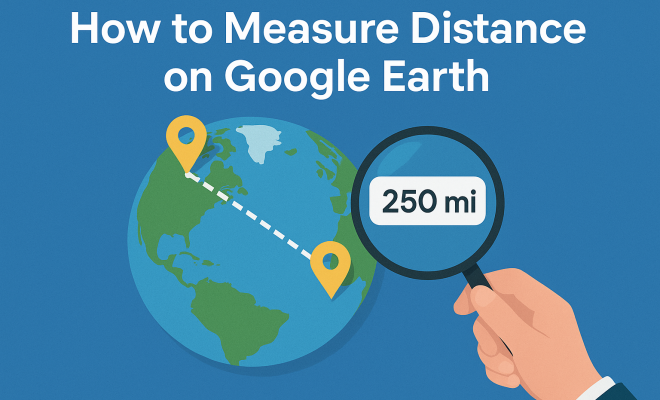
Now, let’s get into the nitty-gritty of how to measure distance on Google Earth. The process is straightforward, and once you know how, it becomes second nature. Here’s a step-by-step guide to help you get started:
- Open Google Earth: Launch the application or website.
- Navigate to Your Starting Point: Use the search feature to locate the starting point of your measurement.
- Activate the Ruler Tool: Click on the ruler icon (which looks like a small ruler) found on the toolbar. This will open the distance measuring tool.
- Select Measurement Type: Choose between ‘Line’ for straight-line measurements or ‘Path’ for measuring multiple points connected by a line.
- Click on Points: Click on your starting point, then move the cursor to your endpoint. Google Earth will display the distance dynamically.
- Read the Measurement: Once you’ve set your points, the distance will be shown in your preferred units (miles, kilometers, feet, or meters).
This straightforward process makes it easy for anyone to measure distances with precision, whether for practical purposes or mere curiosity.
5. Advanced Features: Customizing Your Measurements
While the basic distance measurement tool is highly functional, Google Earth also offers advanced features that enhance your measuring experience. For instance, you can switch between different units of measurement based on your preference. This flexibility is particularly useful if you’re comparing distances in different systems or need specific data for a project.
Moreover, the tool allows you to save your measurements. After completing a measurement, you can click on the ‘Save’ button to retain it for future reference. This is especially handy for planners and researchers who need to document their findings. Additionally, you can create paths with multiple points, making it ideal for plotting travel routes or mapping out land use.
6. Practical Applications: When to Use Distance Measurement
The applications of measuring distance on Google Earth are diverse and impactful. For travelers, it can help in planning road trips by calculating distances between cities or attractions. By understanding the distances involved, travelers can better estimate travel times and plan their itineraries effectively.
In environmental studies, researchers can measure the distance between habitats, helping to assess the impact of urban development or climate change on wildlife. Similarly, urban planners can evaluate distances between key amenities like parks, schools, and residential areas to improve community planning and accessibility. (See: Overview of Google Earth.)
7. Common Issues and Troubleshooting Tips
While Google Earth is generally user-friendly, you might encounter some issues while trying to measure distance. One common problem is the tool not displaying the distance correctly. This can occur if the map view is distorted due to the angle or zoom level. To remedy this, ensure you’re viewing the area from above at a perpendicular angle to the ground.
Another issue might be related to unit settings. If your measurements don’t appear in the desired units, check your preferences in the settings menu. Additionally, if you experience lag or slow performance, consider closing other applications or browser tabs, as they might be consuming your device’s resources.
8. Enhancing Your Experience: Additional Tools and Resources
Aside from the built-in distance measuring tool, Google Earth offers numerous features that can enhance your experience. For instance, you can explore layers that display roads, trails, and even building footprints. Utilizing these layers can provide invaluable context to your measurements.
You might also want to explore Google Earth Pro, which is a more advanced version that includes additional features like higher resolution imagery, historical imagery, and advanced analysis tools. This version is particularly useful for professionals who require in-depth geographical analysis.
9. The Evolution of Google Earth: A Historical Perspective
Google Earth has come a long way since its inception in 2001. Originally a desktop application, it quickly gained popularity for its unique ability to provide users with a satellite view of Earth. Over the years, Google has continued to innovate, integrating additional tools and features that enhance user experience.
In 2017, Google Earth underwent a significant redesign, introducing a more intuitive interface and additional functionalities. The “Voyager” feature allows users to take guided tours of various locations around the globe, enriching the educational aspect of the application. This evolution is a testament to Google’s commitment to improving and expanding the scope of geographic information accessible to the public.
10. Statistics on Google Earth Usage
Understanding the popularity and usage of Google Earth can provide insight into its significance in today’s digital landscape. As of 2023, Google Earth has over 1 billion downloads across various platforms, highlighting its wide appeal. The platform is used not only for recreational purposes but also for educational and professional applications.
Research indicates that nearly 70% of users engage with Google Earth for educational purposes, making it an invaluable tool in classrooms worldwide. Furthermore, environmental organizations use Google Earth to monitor changes in landscapes and assess the impacts of climate change, showcasing its adaptability for scientific research.
11. Expert Perspectives on Google Earth and Distance Measurement
Experts in geography and urban planning often emphasize the value of tools like Google Earth in their work. Dr. Sarah Thompson, a renowned geographer, states, “Google Earth democratizes access to geographic information. It empowers individuals to understand their environment and make data-driven decisions.”
Urban planners also leverage Google Earth for its precision. Michael Johnson, an urban planner, explains, “Measuring distances accurately is crucial for urban development. Google Earth provides an efficient way to visualize and measure distances between critical infrastructure, helping us make informed decisions.”
12. FAQs about Measuring Distance on Google Earth
Q1: Can I measure distance offline on Google Earth?
A1: No, measuring distance on Google Earth requires an internet connection since it relies on satellite imagery that is constantly updated.
Q2: Can I export my distance measurements?
A2: Yes, you can save your measurements and paths in a KML file, which can be shared or opened in other GIS applications.
Q3: What is the difference between ‘Line’ and ‘Path’ measurements?
A3: ‘Line’ measurements provide the distance between two points in a straight line, while ‘Path’ measurements allow you to measure distances over multiple points, creating a continuous route.
Q4: Is Google Earth accurate?
A4: Overall, yes. Google Earth utilizes high-resolution satellite imagery, but the accuracy can vary depending on the location and the type of measurement being taken. (See: Importance of distance measurement in urban planning.)
Q5: How do I change measurement units?
A5: You can change measurement units in the settings menu of Google Earth, allowing you to select between metric and imperial units based on your preference.
13. Future Developments: What’s Next for Google Earth?
The future of Google Earth appears promising, with continuous advancements in technology and data collection. Google is likely to enhance its accuracy, incorporate more real-time data, and expand its features to include augmented reality elements. With the rise of drone technology and improved satellite capabilities, users can expect more detailed and dynamic representations of geographic information.
Furthermore, as environmental concerns grow, Google Earth may play a pivotal role in sustainability initiatives by providing tools for monitoring changes in ecosystems and urban environments. The integration of machine learning could also enhance user experience, making it easier for individuals to extract useful data effortlessly.
In conclusion, Google Earth’s capacity to measure distance is just one of its many features, but it exemplifies the platform’s importance in modern geography and planning. As we move forward, mastering the art of measuring distance on Google Earth will empower users, whether for personal exploration or professional projects.
14. Advanced Measurement Techniques: Using Google Earth for Professionals
For professionals, measuring distance on Google Earth goes beyond simple calculations. Tools like Google Earth Pro offer advanced features that can assist in precise measurements required for planning and analysis. For example, civil engineers may benefit from the ability to measure distances with higher precision when designing roadways or bridges. They can create complex paths that simulate the flow of traffic or assess environmental impacts based on spatial planning.
Additionally, land surveyors can utilize the elevation data provided by Google Earth to measure distances over varying terrains accurately. By factoring in the elevation differences, they can ensure their measurements are not only horizontal but also account for vertical drop-offs or inclines, which is vital in construction and real estate.
Furthermore, Google Earth Pro allows for the importing of GIS data, enhancing the measurement capabilities. Users can overlay maps, add their own data, and even create custom layers for more detailed spatial analysis. This intersection of technology and geography allows for more informed decision-making.
15. Google Earth’s Impact on Urban Planning
The impact of Google Earth on urban planning cannot be overstated. Planners utilize it to visualize existing conditions and propose new developments. By measuring distances between proposed housing developments, public transportation routes, and existing infrastructure, planners can design more efficient and livable cities.
For instance, a city’s zoning commission might analyze distances from residential neighborhoods to commercial zones. By measuring these distances, they can assess accessibility and make decisions on where to place schools, parks, or shopping centers. This kind of analysis is crucial for community engagement and ensuring that development meets the needs of residents.
Moreover, Google Earth provides historical imagery that allows planners to visualize how areas have changed over time. By measuring distances between landmarks at different points in history, they can better understand urban sprawl, the impact of climate change, and other long-term trends that influence current planning efforts.
16. The Role of Google Earth in Environmental Science
Environmental scientists leverage Google Earth for distance measurement to study ecosystems and their changes over time. For example, measuring the distance between wetlands and urban areas can help assess the impact of development on natural habitats. Researchers can analyze how these distances affect water runoff, biodiversity, and species migration patterns.
Additionally, organizations involved in conservation can use Google Earth to monitor deforestation or habitat loss. By measuring the distance between forested areas, scientists can identify fragmentation and its effects on wildlife. This data is essential for creating informed conservation strategies that protect endangered species and restore ecosystems. (See: Google Earth and its impact on exploration.)
Furthermore, Google Earth’s ability to provide real-time data through updated satellite imagery enhances environmental monitoring. With accurate measurements, researchers can track changes in land use, climate effects, and natural disasters, allowing for timely response and policy adjustments.
17. Using Google Earth for Educational Purposes
Google Earth serves as a powerful educational tool in classrooms around the world. Teachers can engage students by using the distance measurement feature to explore geographical concepts hands-on. For instance, students can measure distances between historical sites, which helps them understand the context of historical events and geographical relationships.
Moreover, science classes can utilize Google Earth to study ecosystems by measuring distances between habitats. This can lead to discussions about biodiversity, conservation, and the impacts of human activity on the environment. By incorporating technology into lessons, teachers can foster critical thinking and spatial awareness among students.
Additionally, geography teachers can use Google Earth to illustrate concepts like scale, distance, and mapping. By allowing students to explore the globe and measure distances between various locations, they can visualize the world in a way that traditional maps cannot provide.
18. Case Studies: Real-World Applications of Distance Measurement
Several real-world scenarios illustrate the effective use of Google Earth’s distance measurement capabilities. For example, a community in California utilized Google Earth to plan a new bike path connecting neighborhoods to local schools. By measuring distances, planners were able to ensure safe routes for students, promoting a healthier lifestyle and reducing traffic congestion.
In another instance, environmentalists in Florida monitored the distance between urban areas and wetlands to assess the potential impact of development on local wildlife. By collecting data on these measurements, they were able to advocate for better land-use policies that protect fragile ecosystems.
Moreover, during the planning of the 2022 Winter Olympics in Beijing, organizers used Google Earth to measure distances between event venues. This helped in optimizing transportation routes and ensuring that logistics were efficiently managed, contributing to a successful Olympic event.
19. Conclusion: The Enduring Relevance of Google Earth
As technology continues to evolve, Google Earth remains a vital tool for a wide range of users. From casual explorers to professionals in various fields, the ability to measure distance on Google Earth has proven to be invaluable. Its applications in urban planning, environmental science, and education demonstrate the platform’s versatility and relevance.
By mastering the skills needed to utilize Google Earth’s measurement features, users can enhance their understanding of geography, plan effectively, and make informed decisions. The future looks bright for Google Earth, with ongoing developments promising even more powerful tools and features that will continue to shape how we interact with our planet.
“`
Trending Now
Frequently Asked Questions
How do you measure distance on Google Earth?
To measure distance on Google Earth, select the ruler icon from the toolbar. Click on your starting point, then drag the line to your endpoint. The distance will be displayed in the measurement box. You can switch between different units like kilometers or miles for your convenience.
What are the benefits of measuring distance on Google Earth?
Measuring distance on Google Earth helps in various fields such as urban planning, hiking, and real estate. It allows users to assess land usage, plot trails, and provide critical information about property proximity to amenities, enhancing decision-making for professionals and casual users alike.
Can you measure distance on the Google Earth mobile app?
Yes, you can measure distance on the Google Earth mobile app. Simply tap the ruler icon, select your starting point, drag to your endpoint, and the app will display the distance. This feature is useful for on-the-go measurements while exploring different locations.
Is Google Earth free to use for measuring distances?
Yes, Google Earth is free to use. Users can access it through a web application, desktop software, or mobile app without any cost. This makes it an accessible tool for anyone looking to measure distances and explore geographical features.
What types of measurements can you perform in Google Earth?
In Google Earth, you can perform linear measurements to calculate distances between two points, as well as area measurements to assess the size of a specified region. This functionality is beneficial for a variety of applications, including land assessment and travel planning.
Have you experienced this yourself? We'd love to hear your story in the comments.