Uncovering the Truth: Lake Mead’s Dire Decline and Its Ominous Future
“`html
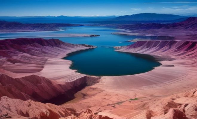
It’s a sight that’s becoming increasingly familiar, yet no less unsettling: the stark, white ‘bathtub ring’ around Lake Mead, stretching higher and higher, a grim testament to the water that’s simply no longer there. For anyone who’s visited this iconic reservoir, or even just seen photographs, the visual impact is profound. We’re talking about the largest reservoir in the United States, a man-made marvel that for decades served as a symbol of human ingenuity and resource management. But today, Lake Mead isn’t just low; it’s plumbing depths not seen since its very inception, roughly 90 years ago. This isn’t merely a statistic; it’s a stark, visual, and deeply concerning indicator of a deepening crisis for the entire Colorado River system, directly impacting the lives and livelihoods of 40 million people across seven states.
The story of Lake Mead’s dwindling water levels isn’t a simple one. It’s a complex narrative woven from threads of prolonged overuse, severe and relentless drought conditions, and the insidious creep of rising temperatures. These factors, acting in concert, have pushed this vital water source to a precipice, forcing federal officials to grapple with uncomfortable truths and implement unprecedented measures. As we delve into the specifics of this environmental and economic challenge, you’ll discover why the current situation at Lake Mead isn’t just a regional concern, but a bellwether for water security in an increasingly arid West, and perhaps, for other regions facing similar pressures worldwide.
The Unsettling Reality of Lake Mead’s Historic Lows
To truly grasp the gravity of the situation, we need to understand what ‘historic low’ actually means in the context of Lake Mead. Imagine a reservoir designed to hold a staggering 28.9 million acre-feet of water when full. An acre-foot, for context, is about 325,851 gallons – enough to cover an acre of land one foot deep, and typically considered sufficient to meet the annual water needs of two average households. For decades, Lake Mead hummed along, a reliable behemoth. But the current levels are a far cry from its historical averages, dipping below the previous record lows set just a few years ago. This isn’t a temporary dip; it’s a sustained, downward trend that has painted the canyon walls with that infamous white mineral stain, marking the high-water line of a bygone era.
The implications of such low Lake Mead water levels are immediate and far-reaching. It’s not just about aesthetics or the reduced capacity for recreational boating. It’s about the fundamental ability of the reservoir to perform its intended functions: providing drinking water, irrigating vast agricultural lands, and generating clean hydropower. When the water level drops, the intake pipes for municipal water supplies can become exposed, and the turbines at Hoover Dam, which generate electricity for millions, lose efficiency, or worse, become inoperable. This isn’t some distant future scenario; it’s happening right now, forcing difficult conversations and even more difficult decisions among states that have long relied on the Colorado River’s bounty.
A Confluence of Crises: Drought, Overuse, and Climate Change
Pinpointing a single culprit for Lake Mead’s decline would be an oversimplification. Instead, we’re witnessing a potent cocktail of environmental and human factors converging to create this crisis. The most obvious, perhaps, is the multi-decade megadrought gripping the American West. This isn’t just a dry spell; it’s a sustained period of exceptionally low precipitation and high temperatures, exacerbated by climate change. Scientists have shown that human-caused warming has made the current drought in the Southwest the most severe in at least 1,200 years. Less snowpack in the Rocky Mountains, which feeds the Colorado River, means less water flowing into Lake Powell, and subsequently, into Lake Mead.
Compounding this natural phenomenon is the historic overuse of the Colorado River’s water. For over a century, the river has been allocated based on calculations from a wetter period, formalized by the 1922 Colorado River Compact. The problem? The river simply doesn’t carry as much water as those early estimates suggested, and certainly not enough to satisfy the ever-growing demands of a rapidly expanding population and vast agricultural enterprises. This structural deficit means that even in years with average rainfall, more water is being taken out of the system than is flowing in. Add to that the increasing temperatures, which accelerate evaporation from the reservoir’s surface and increase water demand in cities and farms, and you have a perfect storm. The hotter it gets, the more water evaporates and the thirstier everything becomes.
Federal Intervention: The Short-Term Pain of Water Cuts
The severity of the Lake Mead water levels has reached a point where passive observation is no longer an option. Federal officials, specifically the Bureau of Reclamation, have been compelled to step in with decisive, if painful, measures. They’ve introduced a short-term plan that mandates significant water cuts for the Lower Basin states: Arizona, California, and Nevada. These aren’t voluntary reductions; they are federally imposed mandates, reflecting the dire straits of the entire Colorado River system. Arizona, in particular, is slated to bear a substantial portion of these initial cuts, given its historical reliance on the river and its junior water rights compared to California.
You might wonder, what does a ‘water cut’ actually entail? For states like Arizona, it means less water delivered from Lake Mead through the Central Arizona Project canal, impacting farmers, industries, and even urban dwellers who rely on that supply. These reductions are not without controversy. Arizona’s Department of Water Resources has publicly labeled the prospect of even more drastic reductions beyond 2028 as “unacceptable,” citing the anticipated devastating economic consequences. This isn’t just about turning off a tap; it’s about re-evaluating foundational economic models, agricultural practices, and urban planning that have been built on the assumption of abundant, affordable water.
The Economic Fallout: From Agriculture to Real Estate
The ripple effects of declining Lake Mead water levels extend far beyond mere inconvenience; they represent a significant economic threat. Agriculture, a cornerstone of the economies in states like Arizona and California, is particularly vulnerable. Farmers who rely on Colorado River water for irrigation face the agonizing choice of fallowing fields, switching to less water-intensive crops, or investing heavily in new irrigation technologies. The costs associated with these adaptations are immense, threatening the viability of family farms and the stability of the food supply chain. (See: Lake Mead water levels data.)
But it’s not just agriculture. The real estate market also feels the squeeze. Property values in drought-prone areas, especially those reliant on the Colorado River, can be impacted as water scarcity becomes a more prominent concern. Developers and homebuyers are increasingly looking at water-efficient homes and communities, understanding that future water availability is a critical factor. Home insurance companies are also beginning to factor drought-related risks into their assessments, potentially leading to higher premiums or altered coverage. Furthermore, the threat to hydropower generation from Hoover Dam is a major concern. Reduced power output means higher electricity costs for millions of people and businesses, adding another layer of economic strain to an already challenging situation. The intertwining of these sectors means that the water crisis is truly a crisis for the entire regional economy.
Beyond 2028: The Looming Specter of Deeper Cuts
While the current federal plan addresses the immediate future, the horizon beyond 2028 looks even more daunting. Officials have issued clear warnings: the current cuts are likely just the beginning. The models and projections indicate that unless there’s a dramatic and sustained increase in precipitation, coupled with even more aggressive conservation efforts, deeper and more painful water reductions will be necessary. This prospect is what has state water managers, particularly in Arizona, sounding alarm bells.
Imagine the implications of even more drastic cuts. What does that mean for a city like Phoenix, which has experienced explosive growth over the past decades? How will it impact the vast agricultural fields that supply much of the nation’s winter produce? These aren’t abstract questions; they are real dilemmas facing policymakers and communities. The discussions around post-2028 management of the Colorado River are already underway, fraught with complex legal battles over water rights, interstate compacts, and the very definition of a sustainable future. It’s a high-stakes negotiation where every acre-foot of water is fiercely contested, and the consequences of inaction or inadequate action are profound.
The Resurgence of the Past: Exposed Historical Sites
One of the more poignant, if somewhat morbid, side effects of the plunging Lake Mead water levels has been the exposure of previously submerged historical sites. For those with an interest in history or a morbid curiosity, these revelations have been a source of fascination. We’ve seen everything from long-lost boats and shipwrecks to the skeletal remains of crime victims, once hidden beneath hundreds of feet of water, now eerily visible along the receding shoreline. It’s a stark visual reminder of just how much water has vanished.
While these discoveries offer a unique glimpse into the past, they underscore the unprecedented scale of the environmental change. The ghost towns and historical artifacts emerging from the depths are not there because archaeologists sought them out; they are there because a vital life source is disappearing. This phenomenon serves as a powerful, tangible symbol of the crisis, capturing public attention in a way that abstract statistics sometimes fail to do. It forces us to confront the reality that the landscape itself is being reshaped before our very eyes, revealing secrets that were never meant to see the light of day again.
Seeking Solutions: Innovation and Conservation in a Thirsty Land
Amidst the gloom, there’s a growing recognition that innovative solutions and aggressive conservation are not just options, but necessities. This crisis is driving significant commercial search intent for technologies and services that can help mitigate the impacts. We’re talking about smart irrigation systems for agriculture that optimize water use, drip irrigation that delivers water directly to plant roots, and advanced soil moisture sensors that prevent overwatering. These technologies aren’t just about efficiency; they’re about survival for many farmers.
In urban areas, the focus is on residential water conservation technologies, from low-flow fixtures and smart sprinkler controllers to greywater recycling systems. The real estate sector is seeing a push for water-efficient homes, not just as an eco-friendly choice, but as a future-proof investment. Beyond technology, there’s a renewed emphasis on policy changes, such as tiered water pricing that incentivizes conservation, and investments in infrastructure that reduce leaks and improve delivery efficiency. Desalination, while energy-intensive and costly, is also being explored as a potential long-term, albeit partial, solution for coastal communities. The sheer scale of the challenge means that a multi-pronged approach, integrating technological innovation, policy reform, and individual behavioral change, will be essential.
The Path Forward: Collaborative Action and Hard Choices
The future of Lake Mead and the Colorado River system hinges on an unprecedented level of collaborative action among the seven basin states, federal agencies, and tribal nations. The historical framework for water allocation, while groundbreaking in its time, is proving inadequate for the realities of the 21st century. New agreements, based on hydrological realities rather than historical averages, are desperately needed. This will require difficult negotiations, compromises, and a willingness to transcend historical rivalries for the collective good.
It’s not just about who gets what share; it’s about how we collectively manage a shrinking resource. This means investing in watershed health, protecting vital headwater ecosystems, and exploring demand management strategies that go beyond mere cuts. For you, the individual, it means understanding your own water footprint and embracing conservation in your daily life. Every drop saved, every efficient appliance installed, every thoughtful landscape choice contributes to the larger effort. The crisis at Lake Mead is a powerful reminder that our most vital resources are not infinite, and their responsible stewardship is a shared responsibility that demands our immediate and sustained attention. The choices we make today will quite literally determine the shape of the American West for generations to come.
Understanding the Hydrological Realities: Beyond Average Flow
When we talk about the Colorado River Compact of 1922, it’s crucial to understand the context. The allocations were based on flow measurements taken during a particularly wet period in the early 20th century. River commissioners at the time estimated the river’s annual flow at around 16.4 million acre-feet. This figure was then divided among the seven basin states. The Upper Basin (Colorado, New Mexico, Utah, Wyoming) was allocated 7.5 million acre-feet, and the Lower Basin (Arizona, California, Nevada) received another 7.5 million acre-feet, with an additional 1.5 million acre-feet reserved for Mexico by later treaties. The problem is, the long-term average annual flow of the Colorado River is actually closer to 12.5 million acre-feet. That’s a huge discrepancy of nearly 4 million acre-feet, or about 25% less water than what was originally believed to be consistently available. This fundamental miscalculation, combined with the drying effects of climate change, created an immediate structural deficit. It means that even if there wasn’t a drought, the system was designed to take out more water than the river naturally provides on average. This isn’t just a historical footnote; it’s the bedrock of the current crisis, making sustainable management incredibly difficult.
The concept of “prior appropriation,” often summarized as “first in time, first in right,” further complicates things. This doctrine, prevalent in Western water law, means that those who first started using water from the river have senior rights, while later users have junior rights. In times of scarcity, junior rights holders are the first to have their allocations cut. This is why Arizona, despite its significant population and agricultural output, often faces larger cuts than California, which holds more senior water rights established earlier. Negotiating new agreements means navigating this complex legal and historical landscape, asking states to potentially give up rights they’ve held for a century. It’s not just about water; it’s about sovereignty, economic stability, and historical precedent. (See: Impact of climate on water resources.)
The Role of Tribal Nations in Water Management
An often-overlooked, yet incredibly significant, aspect of Colorado River water management is the role of the 30 federally recognized tribal nations within the basin. These tribes hold some of the most senior water rights on the river, collectively holding claims to an estimated 20% of the river’s total flow. However, historically, many of these rights have been unquantified or underdeveloped due to a lack of infrastructure or recognition. As the crisis deepens, tribal nations are increasingly asserting their rightful place at the negotiating table, not just as stakeholders but as sovereign entities with significant legal claims. Their participation is crucial for any equitable and sustainable solution. For example, some tribes have begun leasing their water rights to help other communities, providing a new economic avenue while also contributing to regional water management. Their traditional ecological knowledge, honed over millennia of living in arid environments, also offers valuable perspectives on sustainable water use and land management that can inform modern strategies.
Technological Innovations in Water Conservation: Deep Dive
Let’s take a closer look at some of the technological advancements that are becoming lifelines in the struggle against water scarcity. In agriculture, precision irrigation systems are moving far beyond simple drip lines. We’re now seeing remote sensing technologies, like satellites and drones, gathering data on crop health and soil moisture across vast fields. This data feeds into algorithms that precisely determine when and how much water each section of a field needs, minimizing waste. Some systems even use artificial intelligence to predict future water demand based on weather forecasts and crop growth models. This isn’t just about saving water; it’s about optimizing yields with less input, making farms more resilient. For example, in California’s Central Valley, where vast quantities of almonds and other water-intensive crops are grown, these technologies are crucial for farmers facing significant cuts.
In urban environments, smart home technologies are making a tangible difference. Imagine a smart irrigation controller that pulls local weather data and adjusts your sprinkler schedule automatically, skipping watering if rain is predicted. Or smart leak detectors that can alert you to a small leak in your plumbing before it becomes a major problem, saving hundreds or thousands of gallons. Greywater recycling systems, which treat water from sinks, showers, and laundry for reuse in irrigation or toilet flushing, are also gaining traction, particularly in new constructions and water-conscious retrofits. While these individual technologies might seem small, their collective impact across millions of homes and businesses can be substantial, akin to adding a small, continuous stream to the overall water supply.
The Future of Hydropower: Challenges and Alternatives
The Hoover Dam, a marvel of engineering, isn’t just a water delivery system; it’s a massive power generator, supplying electricity to Nevada, Arizona, and California. As Lake Mead water levels drop, the dam’s ability to generate hydropower significantly diminishes. This is because the turbines rely on a certain “head” – the vertical distance between the water surface and the turbines – to operate efficiently. When the water level falls below a critical elevation, known as “minimum power pool,” the turbines become less efficient or even stop working altogether. Lake Mead has already dipped close to these critical levels, forcing some turbines to be shut down. This reduction in clean, renewable energy means utilities have to find alternative sources, often more expensive and carbon-intensive fossil fuels, to meet demand. This adds to electricity costs and works against climate change mitigation efforts.
The challenge isn’t just about the immediate loss of power; it’s about the long-term energy strategy for the region. As hydropower becomes less reliable, there’s an increased impetus to invest in other renewable energy sources like solar and wind power. The sunny Southwest is perfectly positioned for solar, and while these alternatives are growing, they require significant infrastructure investment and grid modernization to fully replace the consistent baseload power provided by the dam. The water crisis, therefore, has profound implications for the energy sector, pushing the region towards a more diversified, but potentially more complex and costly, energy portfolio.
FAQ: Lake Mead Water Levels
Q: What is the current water level of Lake Mead?
A: Lake Mead’s water levels fluctuate daily. For the most up-to-date information, it’s best to check official sources like the U.S. Bureau of Reclamation’s website or their Lake Mead at Hoover Dam water elevation data, which provides real-time and historical levels.
Q: How low has Lake Mead gotten historically?
A: Lake Mead reached its lowest recorded elevation since filling in July 2022, dropping to approximately 1040 feet above sea level. This is a significant decrease from its full capacity elevation of 1229 feet.
Q: What causes Lake Mead’s water levels to drop?
A: The decline is due to a combination of factors: a multi-decade megadrought in the American West, over-allocation of the Colorado River’s water based on outdated estimates, and increasing temperatures exacerbated by climate change, which lead to higher evaporation rates and increased water demand.
Q: How does the dropping water level impact the Hoover Dam?
A: Lower water levels reduce the “head” (the vertical distance of water above the turbines) at Hoover Dam, significantly decreasing its ability to generate hydropower efficiently. If levels drop too low (near “minimum power pool” at roughly 1050 feet), turbines may have to be shut down entirely. Below “dead pool” (around 895 feet), water would no longer be able to flow past the dam. (climate change impact)
Q: What are the primary consequences of low Lake Mead water levels?
A: The main consequences include reduced drinking water supplies for cities, less water for agricultural irrigation, decreased hydropower generation, negative impacts on recreation and tourism, and the exposure of historical sites and previously submerged areas.
Q: Which states are most affected by the Lake Mead crisis?
A: The seven Colorado River Basin states are all affected, but the Lower Basin states of Arizona, California, and Nevada directly rely on Lake Mead’s water. Arizona, with more junior water rights, has historically faced the largest proportion of mandated water cuts.
Q: What is the “bathtub ring” around Lake Mead?
A: The “bathtub ring” is the visible white mineral stain on the canyon walls surrounding Lake Mead. It marks the historical high-water line, showing how much the water level has receded over time due to drought and overuse. It’s composed of minerals left behind as the water evaporates.
Q: Are there any solutions being implemented to address the crisis?
A: Yes, a range of solutions are being pursued, including federally mandated water cuts for basin states, aggressive water conservation efforts in urban and agricultural sectors, investments in water-saving technologies (e.g., smart irrigation, greywater recycling), and negotiations among basin states and tribal nations for new, more sustainable water management agreements.
Q: Can Lake Mead ever fully recover its historical water levels?
A: A full recovery to historical levels (near full capacity) would require multiple consecutive years of exceptionally high precipitation and significantly reduced water usage throughout the entire Colorado River Basin. While temporary increases can occur after wet winters, the long-term trend of climate change and continued demand makes a full, sustained recovery challenging without fundamental changes to water management and consumption.
Q: How does the Colorado River Compact relate to the current situation?
A: The 1922 Colorado River Compact allocated water based on an overestimation of the river’s actual long-term flow. This created a structural deficit, meaning more water was allocated than the river typically provides, contributing significantly to the current water scarcity issues at Lake Mead and throughout the basin.
“`
Trending Now
Frequently Asked Questions
What is causing the decline of Lake Mead?
The decline of Lake Mead is primarily due to prolonged overuse, severe drought conditions, and rising temperatures. These factors have combined to significantly reduce water levels, leading to historic lows not seen in nearly 90 years.
How low is Lake Mead currently?
Lake Mead is at historic low levels, reaching depths not observed since its inception. The reservoir is designed to hold 28.9 million acre-feet of water, but current levels indicate a troubling decline that poses risks to water security for millions.
What impact does Lake Mead's decline have on the Colorado River?
Lake Mead's decline significantly impacts the entire Colorado River system, affecting water availability for approximately 40 million people across seven states. The reservoir's low levels signal a broader water crisis that could have dire economic and environmental consequences.
What measures are being taken to address Lake Mead's water crisis?
Federal officials are implementing unprecedented measures to manage the water crisis at Lake Mead. This includes conservation efforts, water usage restrictions, and negotiations among states that rely on the Colorado River to ensure sustainable water management.
Why is Lake Mead considered a bellwether for water security?
Lake Mead is considered a bellwether for water security because its declining water levels reflect broader trends of increasing aridity and resource strain in the West. Its situation serves as a warning for other regions facing similar challenges in water management.
What's your take on this? Share your thoughts in the comments below — we read every one.