
How MIT Engineers Are Transforming Lidar Technology for a Safer Future
“`html
Lidar technology, a sophisticated sensing technology used in a variety of applications such as autonomous vehicles, robotics, mapping, and defense, has just taken a significant leap forward thanks to engineers at the Massachusetts Institute of Technology (MIT). Their recent breakthrough addresses a longstanding problem in Lidar technology that has frustrated developers and researchers alike. This innovation not only enhances its accuracy but also promises to make it more cost-effective and widely deployable.
Understanding Lidar Technology
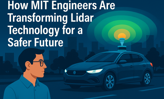
Lidar, which stands for Light Detection and Ranging, uses laser light to measure distances and create precise three-dimensional maps of the environment. This technology has gained substantial traction in recent years, primarily due to its applications in autonomous driving. The ability to accurately perceive surrounding obstacles and navigate complex environments is critical for the safety and reliability of self-driving cars.
In addition to autonomous vehicles, Lidar technology plays a crucial role in other fields, including:
- Robotics: Robots use Lidar to navigate and interact with their environment effectively.
- Mapping: It is essential in topographic mapping, forestry management, and urban planning.
- Defense: Lidar assists in surveillance and reconnaissance missions.
Despite its vast potential, Lidar technology has faced several challenges, particularly concerning its cost and accuracy in various conditions. This is where the recent breakthrough from MIT comes into play.
The Major Lidar Problem
For years, one of the most pressing issues with Lidar technology has been its performance in adverse weather conditions. Traditional Lidar systems struggle with factors such as rain, fog, and snow, which can scatter laser light and lead to inaccurate readings. This limitation has raised concerns regarding the reliability of Lidar in real-world scenarios where environmental conditions are unpredictable.
The breakthrough achieved by the MIT engineering team addresses this critical issue. The researchers have developed a new algorithm that improves the accuracy of Lidar readings in challenging environmental conditions. This advancement could significantly enhance the reliability of Lidar technology in autonomous vehicles and other applications where safety is paramount.
MIT’s Innovative Solution
The engineers at MIT have harnessed advanced signal-processing techniques to refine the way Lidar systems process incoming data. By using a combination of machine learning and sophisticated filtering methods, the team was able to enhance the system’s ability to distinguish between genuine objects and noise caused by environmental factors.
This innovative approach transforms Lidar’s data interpretation, resulting in clearer and more accurate 3D maps regardless of weather conditions. The implications of this advancement extend beyond mere accuracy; they also encompass the operational costs associated with Lidar deployment.
Cost Implications of Improved Lidar Technology
One of the most exciting aspects of the MIT breakthrough is its potential to reduce the cost of Lidar systems. Traditional Lidar setups often utilize expensive components to achieve high accuracy, which can be a barrier to widespread adoption. By improving the algorithm, MIT’s solution allows for the use of less expensive hardware without sacrificing performance.
This cost reduction could lead to more affordable Lidar systems, making them accessible to a broader range of industries and applications. From self-driving cars to urban planning and environmental monitoring, the potential market for Lidar technology is vast, and lowering the cost could catalyze innovation across multiple sectors.
Applications Beyond Autonomous Vehicles
While self-driving cars often dominate discussions about Lidar technology, the implications of MIT’s breakthrough extend well beyond this single application. Here are a few notable areas that could benefit: (See: Massachusetts Institute of Technology.)
- Urban Planning: City planners could utilize highly accurate Lidar data to create detailed models of urban environments, enabling better decision-making and resource allocation.
- Forestry Management: Improved Lidar accuracy can assist in monitoring forest health, mapping biodiversity, and managing natural resources effectively.
- Disaster Response: In the wake of natural disasters, Lidar technology can quickly map affected areas, providing critical data for emergency responders.
Each of these applications highlights the transformative possibilities that arise from combining advanced Lidar technology with efficient data processing methods.
Expert Perspectives on the Breakthrough
Experts within the field of Lidar technology have expressed excitement regarding the MIT team’s achievement. Dr. Emily Chen, a leading researcher in autonomous systems, stated, “This breakthrough not only addresses a significant limitation in existing technologies but also paves the way for new innovations in various fields. The ability to reliably use Lidar in adverse conditions could unlock countless opportunities for research and development.”
Furthermore, industry stakeholders have noted that this advancement could accelerate the timeline for deploying autonomous vehicles in urban settings. With improved safety and accuracy, cities may be more willing to embrace Lidar-equipped vehicles, leading to a more efficient and safer transportation ecosystem.
Historical Context of Lidar Development
The development of Lidar technology has a rich history, dating back to the 1960s when it was first conceptualized for atmospheric research. Over the decades, the innovation of Lidar systems has evolved significantly, transitioning from bulky setups used primarily in laboratory settings to sophisticated devices capable of real-time data collection in various applications.
In the 2000s, the rise of autonomous vehicles spurred interest in Lidar technology, leading to a surge in research and development efforts. Companies like Waymo and Tesla began exploring Lidar for their self-driving systems, prompting a race to improve the technology’s affordability and efficacy.
However, despite the advancements, the challenges surrounding adverse weather conditions have persisted, underscoring the importance of the recent MIT breakthrough in addressing a critical gap in Lidar functionality.
The Future of Lidar Technology
With MIT’s recent advancements, the future of Lidar technology seems promising. As the automotive industry moves toward increasingly autonomous solutions, the demand for reliable and cost-effective Lidar systems will undoubtedly grow. This breakthrough could play a pivotal role in shaping the next generation of autonomous systems.
Moreover, as industries beyond transportation begin to adopt Lidar technology, the potential for innovation and growth will expand. Whether in environmental monitoring, infrastructure development, or disaster management, the applications are limitless.
Challenges Ahead for Lidar Integration
While the recent advancements are undoubtedly promising, challenges remain in the widespread integration of Lidar technology. Regulatory hurdles, public perception, and the need for comprehensive safety standards continue to pose obstacles for both autonomous vehicles and other applications of Lidar.
Additionally, while the MIT breakthrough represents a leap forward, ongoing research will be necessary to further refine Lidar systems and ensure their reliability in all conditions. Collaboration among industry leaders, researchers, and policymakers will be crucial in overcoming these challenges and fully realizing the potential of Lidar technology.
Applications of Lidar Technology in Various Fields
Lidar technology’s versatility is one of its most significant attributes. Beyond the automotive sector, here are several fields where Lidar is revolutionizing processes:
Agriculture
Farmers are increasingly utilizing Lidar technology to improve crop management and yield predictions. Lidar can precisely measure vegetation heights, assess plant health, and monitor changes in land use, allowing for more informed agricultural practices. For instance, by analyzing Lidar data, farmers can optimize irrigation practices, ensuring that they water only the areas that need it the most.
Archaeology
In archaeology, Lidar has proven invaluable for mapping ancient ruins and landscapes that are otherwise obscured by vegetation. By scanning large areas, archaeologists can identify previously unknown sites and gain insights into historical land use patterns. This application has transformed archaeological surveying, making it more efficient and effective. (See: Lidar technology in autonomous vehicles.)
Climate Science
Climate scientists employ Lidar technology to study atmospheric conditions, monitor greenhouse gases, and assess changes in ice cover and sea levels. By providing precise measurements of atmospheric composition and changes over time, Lidar is enhancing our understanding of climate change and its impact on global ecosystems.
Construction and Infrastructure
Lidar technology is increasingly being woven into the construction industry for project planning, execution, and monitoring. By creating detailed 3D models of construction sites, managers can better visualize projects, detect potential issues before they arise, and improve overall efficiency. Lidar can also facilitate the monitoring of infrastructure such as bridges and roads, allowing for timely maintenance and repairs.
Statistics Showcasing Lidar’s Growth
The growth and adoption of Lidar technology are evidenced by various statistics and market analyses. According to a report by Research and Markets, the global Lidar market size was valued at approximately $1.5 billion in 2020 and is projected to reach $4.2 billion by 2026, growing at a CAGR of 19.5% during the forecast period. This growth reflects the increasing demand for Lidar applications across industries, from environmental monitoring to autonomous vehicles.
Frequently Asked Questions about Lidar Technology
What is Lidar technology?
Lidar technology stands for Light Detection and Ranging, which utilizes laser light to measure distances and create precise maps of the environment. It works by emitting laser pulses and measuring the time it takes for the light to return after bouncing off objects.
How does Lidar work?
Lidar systems emit laser beams towards a target and measure the time it takes for the laser light to reflect back to the sensor. This data is then used to calculate distances and create a three-dimensional representation of the environment.
What are the advantages of using Lidar technology?
The advantages of Lidar technology include high precision, fast data collection, the ability to operate in various light conditions, and the capacity to create detailed three-dimensional models of the scanned environment.
What are the limitations of Lidar technology?
Some limitations of Lidar technology include its performance in adverse weather conditions such as rain and fog, as well as the relatively high cost of traditional Lidar systems. However, recent advancements, like the MIT breakthrough, are addressing some of these issues.
What industries benefit from Lidar technology?
Various industries benefit from Lidar technology, including automotive (especially autonomous driving), agriculture, forestry, urban planning, environmental science, and aerospace. Each application takes advantage of Lidar’s precision and ability to generate detailed spatial data.
What is the future of Lidar technology?
The future of Lidar technology looks promising, with ongoing advancements improving its accuracy, cost-effectiveness, and integration across various industries. As more applications emerge, Lidar is expected to play a critical role in reshaping how we interact with our environment.
A Closer Look at Lidar Sensors
The technology behind Lidar sensors is paramount to understanding how these devices function and their various applications. Lidar sensors can be broadly categorized into two types: airborne and terrestrial. Airborne Lidar systems are typically mounted on aircraft or drones, providing high-resolution data over large areas, making them ideal for mapping applications such as forestry management and urban planning. Terrestrial Lidar, on the other hand, is often used for ground-based studies, providing detailed scans of buildings, infrastructure, and smaller geographic areas. (See: Lidar technology in engineering.)
Recent advancements in solid-state Lidar technology, which eliminates moving parts and reduces costs, are also noteworthy. Solid-state Lidar systems are more robust and capable of integrating with other technologies, such as cameras and radar, providing a comprehensive view of the environment. This integration is vital for applications in autonomous vehicles, where the sensors must work seamlessly together to ensure safe navigation.
Comparative Analysis: Lidar vs. Radar vs. Camera Systems
When evaluating the effectiveness of Lidar technology, it is essential to compare it against other sensing technologies such as radar and traditional camera systems. Each technology has distinct advantages and disadvantages:
- Lidar: Provides high-resolution 3D maps and precise distance measurements, making it ideal for object detection and tracking. However, it is susceptible to adverse weather conditions.
- Radar: Performs well in various weather conditions and can penetrate obstacles like fog and rain. However, it generally offers lower resolution compared to Lidar, making it less effective for detailed mapping and object recognition.
- Cameras: Offer excellent color information and can be relatively inexpensive. However, they struggle with depth perception and are heavily reliant on lighting conditions for quality image capture.
In many cases, the integration of these technologies results in superior performance. For example, autonomous vehicles often utilize a combination of Lidar, radar, and cameras to maximize safety and reliability.
Global Market Trends and Future Projections
As previously mentioned, the Lidar market is projected to experience significant growth in the coming years. Various factors are driving this trend, including the increasing demand for Lidar in industries such as automotive, construction, and environmental monitoring. The rise of smart cities and the push towards automation are also contributing to this growth.
According to a recent market analysis, the automotive sector is expected to account for a significant share of Lidar revenue, driven by the rapid development of autonomous vehicles. Companies such as Tesla, Waymo, and others are investing heavily in Lidar technology as they seek to improve their vehicles’ safety and navigation capabilities.
Moreover, advancements in sensor technology and manufacturing processes are expected to further drive down costs, making Lidar systems more accessible to smaller companies and emerging markets. As this technology becomes more widely adopted, its applications will likely diversify, leading to new innovations and market opportunities.
Conclusion: A New Era for Lidar Technology
In conclusion, the recent breakthrough from MIT engineers has solved a long-standing issue in Lidar technology, enhancing its accuracy and affordability. As this innovation gains traction, it opens up a new era for Lidar applications across various sectors, particularly in autonomous vehicles, urban planning, and environmental monitoring.
The implications of this advancement are vast, signaling a future where Lidar technology is not only prevalent but also reliable—even in adverse conditions. As the world continues to embrace automation and smart technologies, the potential for Lidar to revolutionize our understanding and interaction with the environment is more attainable than ever.
“`
Trending Now
Frequently Asked Questions
What is Lidar technology and how does it work?
Lidar, which stands for Light Detection and Ranging, uses laser light to measure distances and create precise three-dimensional maps of the environment. It emits laser pulses and measures the time it takes for them to return after hitting an object, allowing for accurate distance calculations.
How is MIT improving Lidar technology?
MIT engineers have developed a breakthrough that enhances the accuracy of Lidar technology while also making it more cost-effective. This innovation addresses longstanding issues with performance in adverse weather conditions, making Lidar more reliable for various applications.
What are the applications of Lidar technology?
Lidar technology is used in various fields, including autonomous vehicles for obstacle detection and navigation, robotics for effective interaction with environments, mapping for topographic and urban planning, and defense for surveillance and reconnaissance missions.
What challenges does Lidar technology currently face?
Lidar technology faces challenges related to accuracy and cost, particularly in adverse weather conditions like rain, fog, and snow. These factors can scatter laser light, leading to unreliable readings, which is a significant concern for real-world applications.
Why is Lidar important for autonomous vehicles?
Lidar is crucial for autonomous vehicles as it enables them to perceive surrounding obstacles and navigate complex environments accurately. This capability is essential for ensuring the safety and reliability of self-driving cars in diverse driving conditions.
Agree or disagree? Drop a comment and tell us what you think.