Google Maps AR navigation feature
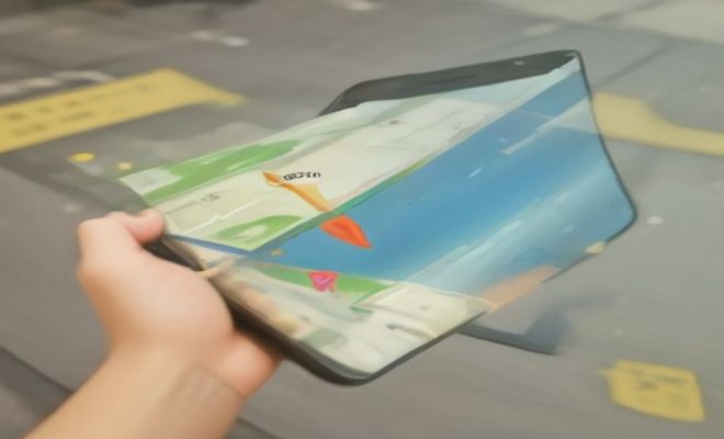
Remember the days when getting lost in a new city was just part of the adventure? Or, let’s be honest, part of the stress? You’d pull out a folded paper map, or maybe squint at a tiny screen, trying to orient yourself amidst a sea of unfamiliar buildings and bustling streets. Those days are rapidly becoming a distant memory, thanks in large part to advancements in mapping technology. Among the most revolutionary is the advent of augmented reality (AR) in navigation, and leading this charge is Google Maps AR navigation, a feature that has subtly, yet profoundly, changed how we interact with our surroundings.
For years, GPS has been a godsend, telling us where to go. But even GPS has its limitations, particularly in dense urban environments or when you’re on foot. That’s where AR steps in, overlaying digital information onto the real world, creating a much more intuitive and immersive experience. Google’s implementation of this technology, often referred to as Live View, takes the abstract blue dot on a map and transforms it into a dynamic, real-time guide that literally shows you the way, right through your phone’s camera. It’s not just about getting from point A to point B anymore; it’s about understanding your environment in a way that was previously impossible without a local guide by your side.
The Genesis of Google Maps AR Navigation: From Lab to Your Pocket
The journey to bringing Google Maps AR navigation to the masses wasn’t an overnight sprint; it was a marathon of technological innovation and user experience refinement. Google has been exploring augmented reality for quite some time, with projects like Google Glass offering an early, albeit somewhat ahead-of-its-time, glimpse into hands-free AR. However, integrating AR into a widely used application like Google Maps presented unique challenges and opportunities. The goal was clear: make navigation more intuitive, especially for pedestrians.
The core idea behind Live View, the specific name for Google’s AR navigation feature, emerged from the realization that traditional 2D maps, while effective for driving, often fall short for walkers. When you’re on foot, particularly in a complex urban setting, knowing which way is ‘north’ or ‘south’ on a map doesn’t always translate immediately to your physical orientation. Are you facing the right direction? Which of these identical-looking streets is yours? Google’s engineers saw AR as the perfect solution to this ‘orientation problem,’ using the phone’s camera, GPS, and a sophisticated understanding of street imagery to provide unambiguous directions.
After extensive testing and iterative development, Live View first rolled out to a limited set of users, including Local Guides and Pixel phone owners, in 2019. This phased approach allowed Google to gather crucial feedback, iron out bugs, and refine the user experience before a broader release. This careful incubation period ensured that when the feature did become widely available, it was robust and genuinely useful, not just a flashy gimmick.
How Live View Works: A Symphony of Sensors and Street View Data
At its heart, Google Maps AR navigation, or Live View, is a marvel of computational geometry and real-time data processing. It combines several technologies to achieve its seemingly magical effect. When you activate Live View, your phone becomes a window to a digitally enhanced reality. First, it taps into your device’s GPS and compass to get an initial fix on your location and direction. This is standard stuff for any navigation app.
However, the real magic happens when it leverages Google’s vast Street View database. Your phone’s camera continuously scans your surroundings, identifying landmarks, buildings, and street signs. This visual data is then compared in real-time with Google’s immense repository of Street View imagery and 3D models of the world. This process, often referred to as ‘visual positioning system’ (VPS), allows the app to pinpoint your exact location with far greater accuracy than GPS alone, especially in areas where satellite signals might be weak or reflected, like between tall buildings.
Once your position and orientation are precisely determined, the app overlays clear, animated arrows, street names, and distance markers directly onto the live camera feed. It’s like having a virtual guide pointing exactly where you need to go. This integration of visual and spatial information makes it incredibly intuitive. Instead of trying to match a blue dot to a street name on a 2D map, you simply follow the giant arrow floating in front of you. It’s a testament to how effectively disparate data sources can be harmonized to create a truly seamless user experience.
The Unmistakable Advantages for Urban Pedestrians
For anyone who’s ever felt disoriented in a bustling city, the benefits of Google Maps AR navigation are immediately apparent. The primary advantage is the elimination of directional ambiguity. How many times have you looked at a map, seen the blue dot, and still weren’t sure if you were facing north or south? Live View cuts through that confusion instantly. You hold up your phone, and a massive arrow literally points down the correct street, making it almost impossible to make a wrong turn right out of the gate.
Beyond simply pointing the way, Live View offers enhanced contextual awareness. When you’re walking, knowing that your destination is ‘just past the bakery on the left’ is often more helpful than a precise coordinate. While Live View doesn’t give you specific landmark cues in spoken directions (yet!), the visual overlay helps you recognize your surroundings much faster. You see the street names pop up, the distance to your next turn, and even the names of nearby businesses, all without having to constantly switch your gaze between your phone and the real world.
This contextual richness is particularly invaluable in dense urban areas where streets can be complex, and traditional GPS signals can be unreliable. Think about navigating a labyrinthine European old town or a crowded Asian marketplace. Live View provides a visual anchor that keeps you grounded, reducing the stress and cognitive load associated with navigating unfamiliar territory. It transforms a potentially daunting experience into a more relaxed and confident stroll. (See: Understanding augmented reality technology.)
Accessibility and Inclusivity: A Broader Impact
While the primary benefit of Google Maps AR navigation is making navigation easier for everyone, its impact on accessibility and inclusivity is also worth highlighting. For individuals who struggle with spatial reasoning, perhaps due to cognitive differences or visual processing challenges, traditional 2D maps can be incredibly difficult to interpret. The abstract nature of a map requires a certain level of mental rotation and translation to match it to the physical world.
Live View bypasses many of these cognitive hurdles by providing direct, visual instructions. There’s no need to mentally rotate a map; the directions are already oriented to your perspective. This directness can be a huge boon for people who might otherwise feel intimidated or excluded by complex navigation tools. It lowers the barrier to independent exploration, empowering more individuals to confidently navigate unfamiliar places.
Furthermore, for those with mild visual impairments, the high-contrast, large arrows and text overlays can be easier to discern than the finer details of a traditional map. While it’s not a solution for severe visual impairment, it certainly expands the usability for a broader range of users. By making navigation more intuitive and less reliant on abstract interpretation, Live View contributes to a more inclusive digital landscape, allowing more people to enjoy the freedom of independent travel and exploration.
Challenges and Limitations: Where AR Still Needs to Grow
Despite its brilliance, Google Maps AR navigation isn’t without its limitations, and understanding these is crucial for realistic expectations. One of the most significant challenges is battery consumption. Running the camera, GPS, and real-time visual processing simultaneously is a power-hungry operation. Using Live View extensively can drain your phone’s battery much faster than standard 2D navigation, making a portable charger almost a necessity for longer excursions.
Another practical limitation is the need for good lighting conditions. The visual positioning system relies heavily on the camera’s ability to ‘see’ and match landmarks. In very dark environments, or in situations with extreme glare, the system might struggle to accurately identify your surroundings, leading to reduced accuracy or even an inability to function. This means Live View might not be your best friend for late-night walks in dimly lit areas.
There’s also the ‘phone up’ problem. To use Live View, you need to hold your phone up, pointing it in the direction you’re walking. While this is fine for short bursts of guidance, walking for extended periods with your arm raised can be tiring and somewhat awkward. It also makes you less aware of your immediate physical surroundings, as your gaze is primarily fixed on the screen. Google has tried to mitigate this by having the system prompt you to lower your phone periodically, but it’s still a compromise between digital guidance and real-world awareness.
Finally, the accuracy of the underlying Street View data is paramount. While Google’s coverage is incredibly vast, there are still areas, particularly indoors or in less-trafficked locales, where the visual positioning system might not have enough data to function effectively. It’s a powerful tool, but like all technology, it has its boundaries.
Privacy Considerations and Responsible Use
Any technology that relies on constant camera input and location tracking naturally raises questions about privacy. When you use Google Maps AR navigation, your phone’s camera is actively scanning your environment. Google has been transparent about how this data is used: primarily for real-time positioning and not for recording or storing video of your surroundings. The visual data is processed on-device and compared against Google’s Street View database to determine your location, but it’s not being sent back to Google’s servers as raw video.
However, it’s still essential for users to be mindful of their surroundings and respectful of others’ privacy. Holding up your phone camera in public spaces, even if you’re just navigating, can inadvertently capture images of people or private property. While the app isn’t recording, the act itself can be perceived as intrusive. Users should exercise common sense and discretion, particularly in sensitive areas or when around individuals who might be uncomfortable being in a camera’s view.
Google has implemented various safeguards, including blurring faces and license plates in its Street View data, which forms the backbone of Live View. But ultimately, responsible usage falls on the individual. The convenience of AR navigation shouldn’t overshadow the importance of privacy and respectful engagement with the physical world around us. It’s a powerful tool, and like any powerful tool, it demands thoughtful application.
The Future is Augmented: What’s Next for AR Navigation?
Google Maps AR navigation, in its current form, is just the beginning of what’s possible with augmented reality in wayfinding. We can anticipate several exciting developments in the years to come. One clear direction is greater integration with other forms of information. Imagine not just seeing an arrow to your destination, but also seeing real-time reviews of a restaurant overlaid on its facade, or a historical plaque virtually appearing on a monument as you walk past.
Improved accuracy and expanded coverage are also inevitable. As Google continues to build out its 3D models of the world and refine its visual positioning systems, Live View will likely become even more precise, functioning reliably in more challenging environments, perhaps even indoors in large public spaces like airports or shopping malls. Imagine navigating the complex terminals of a major airport with AR guiding you directly to your gate or a specific shop.
Beyond smartphones, the eventual widespread adoption of AR glasses could truly revolutionize AR navigation. Imagine a world where the directions are seamlessly projected into your field of view, hands-free, without the need to hold up a phone. This would address the ‘phone up’ problem and allow for a much more natural and immersive experience, blending digital guidance even more seamlessly with your real-world perception. Companies like Google, Apple, and Meta are all heavily invested in this future, and AR navigation will undoubtedly be a killer app for such devices. (See: Google Maps AR navigation feature analysis.)
Beyond Walking: AR in Other Modes of Transport
While Google Maps AR navigation is primarily a pedestrian feature, the underlying technology has implications for other modes of transport as well. While driving, holding up a phone for AR navigation is dangerous and impractical. However, the principles of AR could be integrated into vehicle infotainment systems or heads-up displays (HUDs).
Imagine a car’s windshield acting as an AR display, projecting turn-by-turn directions directly onto the road ahead, highlighting lanes, displaying points of interest, or even warning of hazards. Some luxury vehicles already offer basic HUD navigation, but AR could take this to an entirely new level, providing a much richer and more intuitive driving experience. This would allow drivers to keep their eyes on the road while still receiving detailed, context-aware navigation cues.
Similarly, for cyclists, AR could offer a safer way to navigate. Instead of glancing down at a phone or a handlebar-mounted device, directions could be projected onto smart glasses or a small, unobtrusive display, keeping the cyclist’s focus on the path ahead. The potential for AR to enhance safety and efficiency across various forms of mobility is immense, extending far beyond its current pedestrian-focused application.
Expert Perspectives on AR’s Role in Urban Planning
The rise of Google Maps AR navigation isn’t just a consumer convenience; it’s also piquing the interest of urban planners and smart city initiatives. Experts in this field see AR as a powerful tool for improving urban legibility and fostering more intuitive city navigation for residents and visitors alike. Dr. Anya Sharma, a leading researcher in urban informatics, notes, “AR navigation features like Live View are fundamentally changing our cognitive maps of cities. They provide a layer of immediate, actionable information that traditional signage or even static digital maps can’t offer.”
The ability to overlay real-time data, like public transit arrival times or even dynamic pedestrian flow information, could help individuals make better choices about their routes, potentially alleviating congestion in specific areas. Imagine walking through a crowded plaza and seeing AR indicators suggesting less-trafficked alternative routes, or highlighting the quickest path to a specific train platform during rush hour. This kind of data-rich, visually integrated navigation could lead to more efficient pedestrian movement and a less stressful urban experience for everyone.
Furthermore, AR could play a role in civic engagement. Imagine virtual historical tours that activate as you walk past landmarks, or real-time public art installations that appear on your screen as you explore. This isn’t strictly navigation, but it leverages the same core AR technology to enrich the urban experience, turning every walk into a potential learning opportunity. As cities become increasingly complex, AR offers a way to simplify and enrich our interaction with them.
Comparing Google Maps AR Navigation to Competitors
While Google Maps AR navigation (Live View) is a prominent player, it’s not the only one venturing into augmented reality for wayfinding. Apple Maps has also introduced its own AR walking directions, often with a slightly different aesthetic and integration approach within the iOS ecosystem. Companies like HERE Technologies, a major mapping provider for the automotive industry, are also exploring AR solutions, particularly for in-car experiences.
The key differentiators often lie in the underlying data infrastructure and the accuracy of the visual positioning system. Google’s massive Street View database gives it a significant advantage in many urban areas, providing a rich tapestry of visual data for its VPS to draw upon. Apple, while building out its own mapping data, still faces the challenge of matching Google’s sheer volume in many regions. Some smaller AR navigation apps exist, often focusing on specific niches like museum tours or indoor navigation, but they lack the global scale and comprehensive data of Google Maps.
Ultimately, the competition benefits users, pushing all providers to refine their AR experiences, improve accuracy, and expand coverage. As AR hardware evolves, we’ll likely see more sophisticated and diverse AR navigation solutions emerge, catering to a wider range of user needs and environments.
Frequently Asked Questions about Google Maps AR Navigation
Q: What devices support Google Maps AR navigation (Live View)?
A: Live View is generally supported on most Android phones that are compatible with ARCore (Google’s AR platform) and iPhones running iOS 11 or later that are compatible with ARKit (Apple’s AR platform). This includes most recent flagship and mid-range smartphones from major manufacturers. (See: Research on AR in navigation systems.)
Q: Do I need an internet connection to use Live View?
A: Yes, an active internet connection (Wi-Fi or cellular data) is required for Live View to function. It needs to download map data, Street View imagery, and perform real-time visual positioning against Google’s servers.
Q: Can I use Live View indoors?
A: Currently, Live View is primarily designed for outdoor pedestrian navigation. Its visual positioning system relies heavily on outdoor landmarks and Street View data. While it might offer some limited functionality near windows or entrances, it generally doesn’t work effectively inside buildings like malls or airports.
Q: Is Live View available in all cities and countries?
A: Live View’s availability depends on Google’s Street View coverage and the density of visual data in a given area. It works best in major cities and areas with extensive Street View imagery. While Google is constantly expanding its coverage, it might not be available or as accurate in very rural or less-mapped regions.
Q: Does Live View record video or store images of my surroundings?
A: No, Google states that Live View does not record or store video of your surroundings. The camera feed is processed on your device in real-time to determine your location and orientation, and this visual data is not sent back to Google’s servers as raw video. It uses the visual information to match against existing Street View data.
Q: Why does my phone get warm and battery drain quickly when using Live View?
A: Live View is a resource-intensive feature. It simultaneously uses your phone’s camera, GPS, compass, and processes complex visual data in real-time. This combination of operations requires significant processing power, which generates heat and consumes battery much faster than standard 2D navigation.
Q: Can I use Live View while driving or cycling?
A: Live View is specifically designed for pedestrian navigation. Holding up your phone to use it while driving or cycling is unsafe and highly discouraged. For vehicle navigation, Google Maps offers traditional 2D map views and spoken turn-by-turn directions. See also new features to explore.
Embracing the Augmented Future: A New Way to Explore
Google Maps AR navigation is more than just a fancy feature; it represents a significant leap forward in how we interact with our physical environment through technology. It bridges the gap between abstract map data and our real-world perception, making navigation less about interpretation and more about direct visual guidance. For urban explorers, tourists, and even locals discovering new parts of their own cities, it offers a newfound sense of confidence and ease.
While challenges remain, from battery life to the need for good lighting, the trajectory of AR technology is clear. We are moving towards a future where digital information is seamlessly interwoven with our physical reality, enhancing our understanding and interaction with the world around us. Google Maps AR navigation is a crucial step on this path, inviting us to embrace a more intuitive, visually rich, and ultimately more enjoyable way to explore the world. It transforms the daunting task of finding your way into a guided adventure, one animated arrow at a time.
Trending Now
- Unprecedented: Ransomware Attacks Just Spiked — Your Industry Might Be Next
- this guide on the astonishing ai deepfake threat: why content creators need identity theft insurance now
- Unmasking the Deepfake Deceit: Your Essential Guide to AI Scams
- Urgent: AI Deepfake Scams Just Hit a Disturbing New Low
- this guide on unmasking the ai imposters: 7 cybersecurity solutions every brokerage needs now
Frequently Asked Questions
What is Google Maps AR navigation?
Google Maps AR navigation is an augmented reality feature that enhances navigation by overlaying digital information onto the real world. Known as Live View, it transforms your phone's camera feed into a dynamic guide, helping users navigate more intuitively, especially in dense urban environments.
How does Google Maps AR work?
Google Maps AR works by using your phone's camera to display real-time navigation instructions overlaid on the actual streets and surroundings. It utilizes GPS and advanced computer vision technology to identify your location and provide directions visually, making it easier to find your way.
What are the benefits of using AR in navigation?
The benefits of using AR in navigation include a more intuitive experience, improved situational awareness, and the ability to understand your surroundings better. It helps pedestrians navigate complex environments by providing clear visual cues directly on their camera feed.
Is Google Maps AR navigation available for everyone?
Google Maps AR navigation is gradually being rolled out and may not yet be available to all users. It is primarily available on compatible smartphones, and its availability can vary by location. Users should ensure their Google Maps app is updated to access the feature.
What was the inspiration behind Google Maps AR navigation?
The inspiration behind Google Maps AR navigation stemmed from the need to improve pedestrian navigation in complex urban settings. Google aimed to create a more intuitive and immersive experience, moving beyond traditional GPS methods to help users understand their environment better.
What's your take on this? Share your thoughts in the comments below — we read every one.